When streets turn into shallow rivers, the question for autonomous vehicles is simple and unforgiving: do they stop in place, or do they improvise? In San Diego’s late-October coastal flooding, multiple Waymo robotaxis chose to stop—some reversed, one needed police help—and the resulting standstill is a clear, instructive case study in how driverless systems handle water, one of the hardest perception and planning problems in urban driving.
At a Glance
- Several Waymo robotaxis stopped, reversed, and stalled on flooded San Diego roads; at least one required police assistance.
- A passenger reported being stuck inside a halted vehicle as traffic backed up during king-tide flooding.
- San Diego officials had active coastal flooding alerts in place, confirming the hazardous conditions citywide at the time.
- The episode echoes a broader operational challenge for AVs: reliable detection and response to standing water.
What happened in San Diego’s flooding
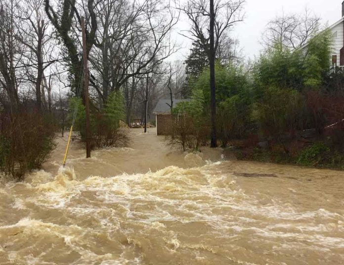
Contemporaneous video and reporting show several Waymo robotaxis encountering floodwater on San Diego streets and coming to a standstill. Witness footage captured vehicles stopping and in some cases reversing before halting; one vehicle ultimately drew police assistance, illustrating that human intervention became necessary in at least one instance. A separate account described a passenger stuck inside a stopped Waymo while traffic accumulated, underscoring the rider experience when an AV parks itself in an ambiguous environment rather than proceeding. While not every vehicle’s exact location or depth of water is cataloged, the consistent depiction across reports is that floodwater produced indecision or a conservative stop response in multiple vehicles that afternoon and evening.
These events unfolded against officially recognized conditions: the City of San Diego posted a Coastal Flood Warning transitioning to a Coastal Flood Advisory spanning October 29–30, a period characterized by king tides and storm effects along the coast. That municipal alert corroborates that drivers—human or automated—were navigating a landscape with elevated water levels, overtopped curbs, and pooled intersections. In that context, the behavior observed on video reflects the operational edge cases that often reveal an automated system’s true safety posture: hesitate and hold, or commit and risk a misread of depth and flow.
https://www.youtube.com/watch?v=61NjaUndkX4
Why floodwater is so hard for driverless systems
To a human driver, shallow standing water can look deceptively benign; depth perception is imprecise, but experience supplies guardrails—speed down, avoid dark patches, never aim for a wake. For an autonomous vehicle, floodwater is a composite challenge that strikes the perception stack and the motion planner at once. Cameras lose texture and lane paint beneath reflections; lidar pulses scatter on a dynamic, glossy surface; radar returns can be ambiguous at the low heights that matter for tires and underbody clearance. The planner must decide whether the surface is traversable and, if so, at what entry angle and speed; a conservative system will default to stopping if confidence in classification drops below threshold. The San Diego footage is a clean example of that conservative bias. It halts traffic, but it prevents the costlier mistake—driving into deeper-than-expected water that hides a pothole, curb, or flowing crosscurrent.
This is not an abstract dilemma. Earlier in 2026, Waymo filed recall documentation with federal regulators after an unoccupied robotaxi encountered an untraversable flooded section on a higher-speed roadway and did not fully stop; the company initiated a software remedy across approximately 3,800 vehicles to improve handling of flooded lanes and avoidance logic. Regulators framed the risk plainly: entering a flooded roadway can lead to loss of vehicle control. That history matters here because it shows the company has already recognized and addressed aspects of water-handling logic at speed; low-speed urban flood pools present a different but related classification and planning test, one that San Diego’s scenes brought into relief.
Safety posture or failure mode? The right frame for what the videos show
Two interpretations often compete in episodes like this. One reads the stop-and-freeze behavior as a system failure—evidence the AV “didn’t know what to do.” The other treats it as a safety posture—evidence the AV refused to guess. The San Diego material supports the latter more than the former. Multiple vehicles stopped and, where they moved, did so in short reversals rather than accelerating into uncertain depths; police assistance to reposition a single vehicle is consistent with a conservative design that requires human help to re-route out of an inoperable lane rather than experiment with water it cannot characterize. The fact pattern does not indicate vehicles attempting to push through floodwater and losing control; it shows the opposite, with the human cost being delay and localized congestion rather than damaged vehicles or injuries.
At the same time, a stop posture has real-world consequences. A robotaxi that parks itself mid-block or at an intersection becomes an obstacle others must work around; a rider sealed inside waiting for clearance experiences vulnerability and frustration. Operators must therefore do more than “fail safe”; they have to fail operationally—detect the hazard early enough to avoid entering a geometry where the only safe option is to stop and wait. The San Diego incident highlights that margin: route selection, flood-aware geofencing along known tide-prone corridors, and preemptive service throttling during advisories can keep vehicles out of exposure zones altogether when water is likely to pool.
How we got here: the interplay of software, maps, and operations
Modern robotaxis navigate with a fusion of high-definition maps, onboard sensors, and policy layers that govern behavior under uncertainty. Floodwater undermines each layer. Maps can indicate low-lying segments but cannot predict transient pooling at curb cuts; sensors can detect specular surfaces but struggle to infer depth; policy can demand caution but not conjure an escape path once boxed in by parked cars and a rising tide. The operational lever—the one outside the AI stack—is service management. If a city posts a coastal flood warning or advisory, an operator can proactively constrain the service area, bias routing to higher ground, or lower the confidence thresholds that trigger a remote assistant to intervene earlier. Those are choices as much as code paths, and they determine whether a fleet is merely safe when surprised or resilient by design during predictable events.
Seen through that lens, San Diego’s episode is less an indictment of autonomy than an audit finding: the system chose safety over bravado, but the operating playbook left vehicles in places where stopping stranded riders and clogged traffic. It is solvable—in software, in routing policy, and in real-time operations. The recall earlier in the year addressed flooded-lane behavior at speed; the urban case sharpens the next set of requirements: confidence-calibrated water detection at low speed, conservative approach angles near visibly pooled intersections, and wider geofenced buffers during king tides and storm surge.
Consequences and the path forward
For riders, the practical question is reliability. A service that halts during common coastal flooding is, in effect, a fair-weather taxi; that may be acceptable if communicated and priced accordingly, but it erodes trust if surprises cascade into long holds inside a sealed cabin. For cities, the question is interoperability with public safety. San Diego’s police assistance shows that integration is already happening informally; formalizing it—clear dispatch codes for AV standby, authority for limited manual repositioning, and post-incident data exchange—turns ad hoc rescues into routine playbooks that clear blockages faster and document performance for continuous improvement.
For the industry, the technical target is better water reasoning. That means improving perception for mirror-like surfaces, training planners to prefer predictable shorelines over ambiguous center pools, and building routing models that discount flood-prone links dynamically when advisories are active. None of this requires new physics; it requires disciplined systems engineering and the humility to treat some weather as operationally disqualifying. The San Diego videos did not show reckless autonomy; they showed conservative autonomy encountering the limits of its operational envelope—and defaulting to the safe choice. Make that envelope smarter, and fewer rides end in standstill.
Driverless cars are great right up until the street turns into a river. Flooding is the real stress test.
King-tide flooding in San Diego left several Waymos stuck, and a police officer had to step in to get a rider moving.
Should a driverless car know when to give up? @Waymo https://t.co/L70gdh77JW
— Deven Baskota (@paddleurway) October 30, 2026
Bottom line
Flooding exposed a familiar truth about autonomous systems: when the environment erases signal, prudence looks like paralysis. In San Diego, several Waymos stopped rather than gamble on water depth, one needed police help, and at least one rider was stuck inside as traffic built. The city’s flood alerts confirm the hazard, and recent recall filings show why erring on the side of a halt is rational when water is misread at speed. The work now is not to eliminate caution but to move it upstream—route away from the river that used to be a street, so the safest decision never has to be a gridlock-inducing stop.
Sources:
youtube.com, usatoday.com, weather.com, thechargeport.com, newsbreak.com, sandiego.gov