
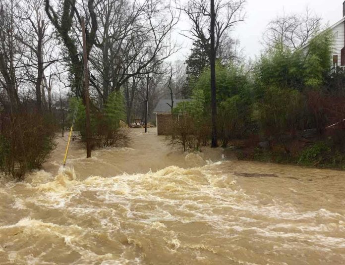
Urban flooding becomes dangerous long before it becomes historic; Port St. Lucie’s rain event is a textbook case where operational reality — inundated arterials, emergency declarations, and delayed drainage over saturated ground — set the stakes, regardless of whether the storm broke records.
At a Glance
- Port St. Lucie and St. Lucie County declared local States of Emergency to accelerate resources and response.
- Major roadways — including California, Savona, and parts of Port St. Lucie and Prima Vista boulevards — were closed due to flooding.
- The National Weather Service issued a flood warning citing excessive rainfall and slow-moving urban drainage that would take hours to clear.
- Public-safety guidance urged residents to avoid unnecessary travel and to never drive through standing water.
What Happened: A Municipal Emergency Driven by Excessive Rainfall and Saturated Ground
City and county officials did not equivocate: Port St. Lucie formally declared a local State of Emergency to manage a rain-driven flood that disrupted transportation and municipal operations. The declaration aligned with St. Lucie County’s posture and, crucially, enabled the city to expedite assistance and resources as conditions evolved. While the term “emergency” is administrative rather than a climatological ranking, it signals the same thing residents saw on the ground — water where roadways should be, closures, and safety instructions moving from cautionary to categorical.
The National Weather Service (NWS) reinforced the urgency with a flood warning for St. Lucie County that described flooding as imminent or already occurring in low-lying and flood-prone locations. The language matters: the hazard was not just rainfall totals, but the interaction of continued downpours with already saturated ground, and the reality that water would take hours to move through urban drainage systems — in other words, even if the rain paused, the impacts would not. That combination of antecedent saturation and sluggish egress is exactly what transforms a strong rain into a day of blocked intersections and stranded motorists.
Road Closures and City Operations: The Operational Footprint of the Flood
Flooding is best measured by what it stops. The city documented multiple primary closures that defined the response footprint: California and Savona boulevards, stretches of Port St. Lucie Boulevard near Aviation Avenue, and eastbound Prima Vista Boulevard west of Airoso Boulevard, among others. Many neighborhood streets also became impassable, creating a mosaic of detours and no-go zones that complicate both resident travel and emergency access. That complexity extended into city business; even scheduled governance was interrupted, with the Planning and Zoning Board meeting canceled and its agenda shifted forward weeks — a small but telling indicator of disruption reaching beyond the right-of-way.
Public-safety messaging tracked the evolving hazard precisely. Residents were urged to avoid travel unless absolutely necessary and to never drive through standing water — guidance that reflects the physics of vehicle buoyancy and the opacity of floodwater, which hides washouts, open manholes, and stalled cars. Those imperatives may read like boilerplate until you consider the typical flash flood fatality profile: people misjudge depth or current and attempt a crossing. The city deliberately tried to break that chain.
Mechanism: Why Streets Flood When Storms Aren’t “Historic”
Flooding in South Florida is not a single-variable story; the hazard emerges from how rainfall intensity and duration meet antecedent soil saturation, flat topography, high impervious cover, and the finite hydraulic capacity of stormwater systems. When drainage inlets, pipes, and canals receive more inflow than they can convey — whether because of peak intensity in a short window, debris at inlets, or backwater effects downstream — water ponds on streets and in low-lying yards. Regional emergency guidance catalogs these causes explicitly, and Port St. Lucie’s warnings mirrored that playbook: excessive rainfall over saturated ground plus urban drainage that needs time to catch up.
Two points often get conflated in public discourse. First, an event can be fully “operationally dangerous” — closing arterials and triggering an emergency posture — without being provably unprecedented on a century-scale. Second, short-duration intensity drives street flooding more than day-long totals do. That is why meteorologists and hydrologists use recurrence intervals and intensity–duration–frequency curves when they evaluate storms and infrastructure performance, not just the calendar-day inches. NOAA’s hydrometeorological assessments and Atlas-derived metrics are designed to answer the “how rare” question but are not prerequisites for declaring — or experiencing — an emergency.
Evidence and Limits: What the Record Establishes, and What It Doesn’t Need to
The public record anchors the core facts securely. The city’s emergency declaration is on file, as are its lists of closures and safety directives. The NWS flood warning describes the causal chain — excessive rainfall, saturated ground, delayed urban drainage — and explicitly anticipates additional flash-flood warnings if heavy rain were to persist overnight. Those statements together substantiate the central claim of widespread, rain-driven disruption.
What the official texts do not do is convert the episode into a superlative — they do not publish a station identifier for a 4.9-inch short-duration total, nor do they rank the event against the full instrument record for Port St. Lucie. That omission does not dilute the policy or safety relevance of the event; it simply delineates the difference between an emergency operations narrative and a climatological analysis. In practice, municipal managers act on what is happening and what will happen in the next 6–24 hours; climatological rarity can be assessed later with gauge and radar archives. One brief caveat is appropriate here: absent a formal hydrologic after-action report, we cannot apportion causal shares among rainfall intensity, blocked inlets, or downstream constraints — and the city’s communications did not attempt to.
Consequences and Next Steps: Infrastructure, Behavior, and Risk
Urban floods reveal system constraints in real time. Streets that repeatedly pond under similar storms are signaling hydraulic bottlenecks: undersized conveyance, limited storage, grade-controlled outfalls, or maintenance gaps. Across South Florida, cities are already weighing a mix of upgrades — larger pipes, increased inlet density, greened rights-of-way for storage and infiltration, and pump or weir adjustments — because the cost of detours, stalled vehicles, and emergency activations is cumulative. Regional reporting and resilience planning in recent years has underscored how extreme rain has stressed stormwater infrastructure and focused public attention on flood risk and capital spending priorities.
But infrastructure is only half the equation. Public behavior in the first hour of a flood wave is decisive. The city’s insistence on avoiding travel and never driving through standing water is not rhetorical; shallow moving water can lift and disable a sedan, and floodwater is electrically and biologically hazardous. Turn-around decisions reduce rescue demand, free up limited response assets, and prevent secondary crashes at barricades. In Port St. Lucie, those messages were clear and aligned with national best practice: turn around; don’t drown.
Kids were seen stepping off a school bus into waist-deep floodwater as torrential rain inundated streets in Port St Lucie, Florida, on Nov. 2. As of Monday evening, between 14 and 22 inches of rain was recorded in the area. And for Tuesday, flood warnings remained in place for… pic.twitter.com/8yhQB6Z0gV
— Eyewitness News (@ABC7NY) November 3, 2026
How to Read Events Like This Going Forward
When the next rain event arrives, the most useful questions are operational, not superlative. What are the near-term rainfall rates and their duration? How saturated is the basin, and how quickly can the system drain between cells? Which intersections are historically vulnerable, and are barricades staged ahead of time? Are there sensitive operations — schools letting out, polling stations, medical facilities — along routes likely to pond? Officials answered those questions in Port St. Lucie with closures, cancellations, and plainspoken safety guidance. Residents help close the loop by staying off flooded streets and reporting blocked inlets or failures promptly.
The larger arc is familiar across the peninsula: as heavy downpours meet built environments with limited hydraulic slack, more cities will experience events that are disruptive without being singular in the climate archives. Preparedness lives in that space — in accurate warnings, disciplined travel behavior, and a patient, well-funded program of drainage improvements calibrated to both today’s storms and tomorrow’s.
Sources:
facebook.com, cityofpsl.com, forecast.weather.gov