
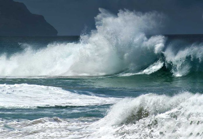
When ocean water crosses the beach and runs the streets on a blue-sky morning, it is rarely one culprit; it’s the alignment of tide, swell, water-level anomalies, and a nearby storm that turns a familiar shoreline into a shallow bay. That is exactly the setup Southern California faced as Tropical Storm Rachel angled toward the region: a credible tropical threat, already-elevated coastal water levels, and surf capable of pushing water into low-lying neighborhoods.
The Short Version
- The National Hurricane Center placed part of the Southern California coast under a Tropical Storm Watch as Rachel moved northeast, with 50 mph sustained winds and higher gusts in the forecast.
- Official guidance warned not just of wind and rain but of life-threatening surf and coastal flooding along Southern California as swells built ahead of the storm.
- Local TV outlets documented flooding in beach communities, including street and garage inundation in Newport Beach and adjacent areas as tides and surf rose.
- Watches signal that hazardous conditions are possible within the specified area; they are designed for uncertainty, not certainty, and are issued ahead of impacts to buy time for preparation.
What the official forecast said—and why it mattered
By October 9, the National Hurricane Center (NHC) had Rachel moving northeast at about 5 mph and explicitly on track to approach northern Baja California or Southern California late Saturday into early Sunday. Maximum sustained winds were near 50 mph, with higher gusts. Crucially for coastal residents, the public advisory emphasized that swells tied in part to Rachel would build along the Southern California coast, producing life-threatening surf and the potential for coastal flooding—hazards that often materialize before the first rain band arrives. This was not a wind-only event; it was a water-and-wave event with real coastal exposure.
To emphasize that exposure and the plausible reach of hazardous conditions, the NHC issued a Tropical Storm Watch for the U.S. coast from the Mexico border north to the San Diego/Orange County line. A watch is an early, precautionary signal: conditions are possible, not guaranteed, and the geography reflects forecast uncertainty in track and size. The point is lead time—hours to secure loose property, review flood gates, stage sandbags, and plan vehicle parking with tides in mind.
How water gets from the beach to your front steps
Coastal inundation along south- and southwest-facing beaches is a compound phenomenon. Start with the astronomical tide—the predictable rise and fall driven by the sun and moon. Layer on short-term sea-level anomalies from large-scale ocean features; during strong El Niño episodes, coastally trapped Kelvin waves can elevate regional water levels by half a foot or more for weeks to months, raising the baseline atop which every tide rides. Then add incident swell: long-period waves don’t just break; they transfer momentum shoreward, setting up water along the beach face and driving wave runup well beyond the still-water line. Even a modest meteorological surge from a passing storm can tip the balance from “close call” to “over the curb.”
Rachel’s forecast matched this template. The storm’s approach promised increased swell and dangerous surf ahead of landfall timing, aligning with already high morning tides. In practice, that is when drives flood: the wave that breaks over the berm pushes a sheet of water into streets and garages, and the next set arrives before the first sheet fully drains. The NHC’s hazard language—life-threatening surf and coastal flooding—speaks directly to this mechanism: the risk is driven at least as much by wave energy and elevated coastal water levels as by wind on a given block.
What played out locally along the coast
While national advisories set the big frame, street-scale reality came into view through local reporting. Southern California broadcasters documented water overtopping familiar lines in multiple communities as the tide peaked and surf built. KTLA described ocean water reaching garages, streets, and alleys in locales including Newport Beach and the back bay, with a coastal flood advisory in effect as morning tides climbed. The description fits the compound-flooding profile: higher-than-usual water on the beach platform, then wave-driven runup pushing inland.
Elsewhere along the same exposure arc, residents reported pounding surf and damage to seaside infrastructure as the event intensified—consistent with the NHC’s warning that hazardous surf would precede or accompany Rachel’s closest approach. These are the outcomes that matter to homeowners and city crews: not the centerline of a forecast cone, but whether the next set reaches past the sidewalk into a ground-floor unit, and how long it takes for that water to recede between sets.
How watches work: signal, uncertainty, and decision windows
Forecast offices issue watches and warnings with uncertainty baked in by design. A watch means hazardous conditions are possible within the area; it is not a verdict that every mile of coastline will experience identical impacts. The NHC and local National Weather Service (NWS) offices coordinate these products with an eye toward lead time: get credible risk in front of emergency managers and the public early enough to act. Historically, track forecasts at the 36-hour horizon can still miss by tens of nautical miles, a material offset at landfall that meaningfully shifts which beaches experience the worst runup. That is why the products describe hazards probabilistically and across zones.
For coastal residents, the right mental model is practical: if your neighborhood sits within or adjacent to a watched or advisory zone and you face south or southwest, assume the combination of high tide and rising surf can produce street-level water, even on a clear morning. Move vehicles to higher ground before the tide cycle peaks; protect ground-floor electrical and valuables; and treat sandbag placement as cheap insurance. The watch is not an abstract; it is a countdown.
🚨 BREAKING: Large waves from Tropical Storm Rachel are flooding homes along the Southern California coast.
Waves breached a bulkhead in Long Beach, flooding nearby streets and communities.
Rachel expected to approach Southern California and northern Baja California at tropical… pic.twitter.com/dvk1f98F9z
— EzeNews (@EzeBets) October 10, 2026
Why this pattern will recur—and how to get ahead of it
Southern California’s vulnerability to compound coastal flooding is not an anomaly; it is a recurring feature of its exposure. The region’s long, low-lying beach communities, river mouths, and bays place homes and businesses within a few vertical feet of typical high tide. Superimpose multiday water-level anomalies and long-period swell, and minor to moderate flooding becomes likely even without a direct landfalling cyclone. Research and operational practice both point to the same conclusion: the most reliable defense is advance preparation anchored to tides and forecast surf.
For city planners and flood managers, the operational checklist is clear. Align temporary protections with the daily tide table during watch periods; stage pumps where gravity drainage is poor; pre-position debris crews at known choke points; coordinate with harbor authorities on vessel moorings; and synchronize public messaging around specific tide hours rather than calendar days. The NHC’s expansion of hazard-focused guidance—beyond wind to include surf, surge, and rainfall—supports exactly this street-level planning mindset.
A note on geography and language
The NHC’s Tropical Storm Watch extended from the U.S.–Mexico border to the San Diego/Orange County line; adjacent communities to the north, including parts of Orange County, were subject to local NWS surf and coastal flood advisories as the same water-level and swell processes unfolded. The semantics matter less to the resident standing in ankle-deep saltwater than the mechanics: with Rachel approaching, the coastal hazard environment extended along much of Southern California’s south- and southwest-facing shoreline, and the documented street and garage flooding fit the hazard profile officials described.
Sources:
thegatewaypundit.com, nhc.noaa.gov, journals.sagepub.com